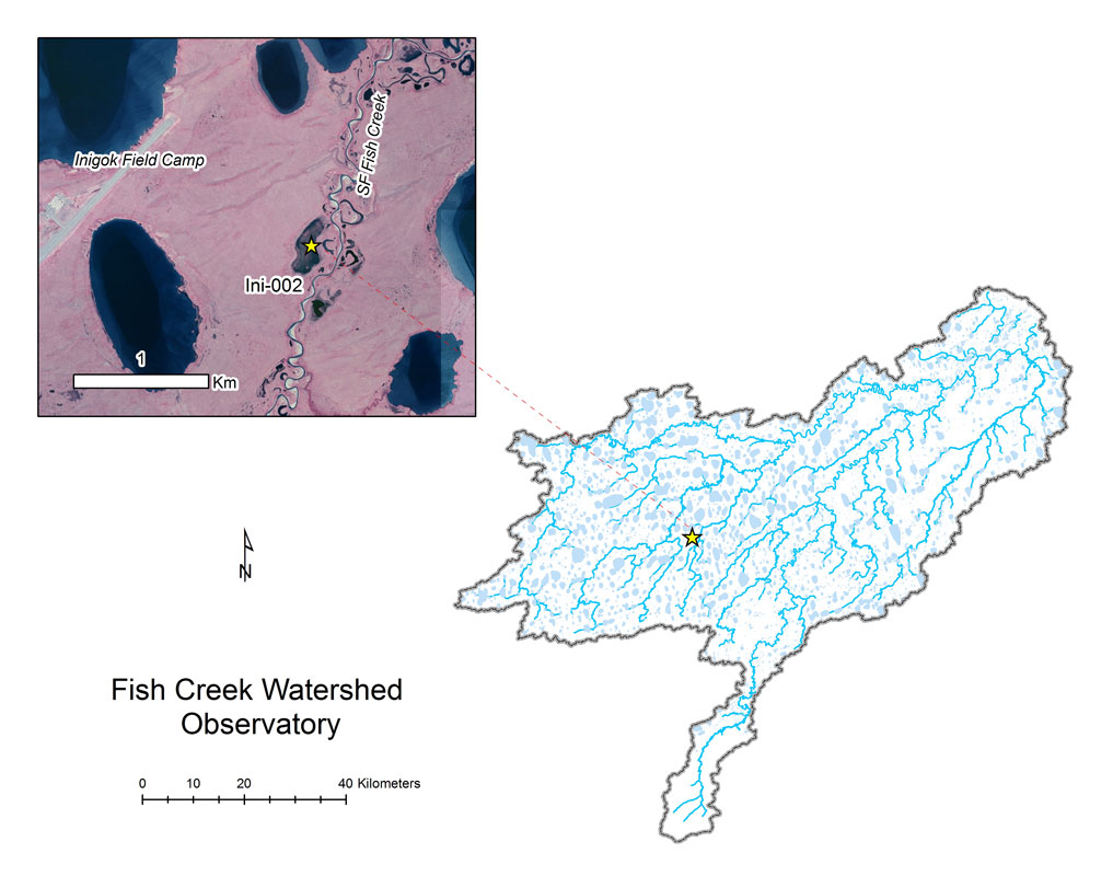
- Station Name:
- Ini-002
- Latitude:
- N 70.000°
- Longitude:
- W 153.037°
- Elevation:
- 40.6 masl
- Lake Area:
- 1.3 ha
- Mean Depth:
- 0.8 m
- Record:
- 2011-2017 (discontinued)
- Purpose:
More of a wetland than a pond or lake, these macrophyte chocked waters freeze solid in the winter, yet support dense populations of large-bodied zooplankton in the summer. Also popular lake with loons and many other aquatic birds, this site was part of the Circum-Arctic Lake Observation Network (CALON) from 2012-2015.
Select Published Studies on Ini-002:
- Beaver, J. R., Arp, C. D., Tausz, C. E., Jones, B. M., Whitman, M. S., Renicker, T. R., Samples, E. E., Ordosch, D. M., and Scotese, K. C., 2019. Potential shifts in zooplankton community structure in response to changing ice regimes and hydrologic connectivity. Arctic, Antarctic, and Alpine Research, 51(1): 327-345.
- Arp, C. D., B. M. Jones, G. Grosse, A. C. Bondurant, V. E. Romanovsky, K. E. Hinkel, and A. Parsekian. 2016. Threshold sensitivity of shallow arctic lakes and sub-lake permafrost to changing winter climate. Geophysical Research Letters. DOI:1002/20016GL06506